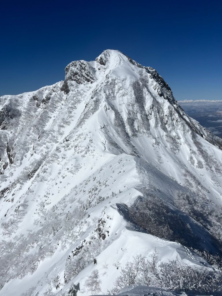
Mt Amida (2,805m) sits right next to Mt Aka in the winter playground of Yatsugatake, just a couple of hours on the train from Tokyo. It’s big, accessible and a lot of fun. There are several ways to the top, and this is probably the second easiest. It might not look like it when you’re driving up the hill from Chino, as Amidadake is what’s looming above you, but it’s not as hard as it looks from a distance – Scottish Grade I, but with lots of snow and the potential for very low temperatures.
It’s doable in a single big day, but much more reasonable with an overnight stop at Akadakekousen the night before. Head up from Minotoguchi (J&N is a fantastic place for an overnight stay) on the usual trail to Akadakekousen and spend the afternoon reading, lounging, climbing on Ice Candy or exploring the first couple of pitches of Jogosawa (a 15 minute walk from the hut) if you fancy some easy ice leads.
To get to Amidadake, take the main path south-east as if you were climbing Akadake. When you reach the Gyouja hut, if the weather’s clear Mt Amida will be in full, intimidating view. The routes you can see from the hut are the north and north-west ridges (III+ and 5.9 IV A1) – this route is on the left, and much easier.
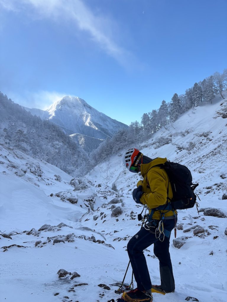
To get onto the route, there are 2 options: you can start up the route for the north ridge – this takes a right fork at a signposted junction about 500m from the Gyouja hut; the well-trodden Bunzaburo path heads left and south-east, the north ridge path heads right and south-west up into the forest. Head up through the forest for about 900m and about 250m of elevation until you come out of the trees and onto a clear ridge – just before you reach the obvious climbing on the north ridge head left (south) across the wide gully into the col at the foot of the east face. Be careful here – this area gets a LOT of snow and this gully can be avalanche prone.
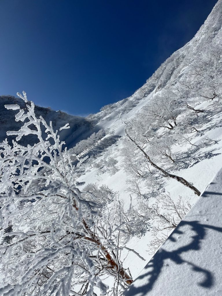
When I climbed this it had been snowing heavily for a couple of days – I was on my own and there was no trail across the gully at all, so I decided not to risk it and took the safer route; up via the Bunzaburo ridge and Nakadake.
To get there, I retraced my steps to the junction, but if you’re coming up from the Gyouja hut just turn left at the fork instead of right, and head up the Bunzaburo as if you’re climbing Akadake. It’s steep going, but relatively safe and extremely well trodden. Keep heading up until you come across the west face of Mt Aka and land on the signposted col between Mt Aka and Mt Amida. From here, turn right (west), head up and over Nakadake and after about 1000m you’ll be on the col at the foot of the east face.
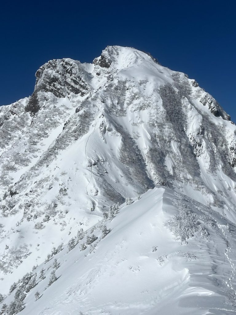
From here, just head up! It’s very steep (there’s a ladder to get you through the rocks just above the col) and the snow can get deep and soft, but it’s never technical. The route goes straight up the front, then around to the right to meet up with the top of the north ridge. The summit’s big and ideal for a quick snack and a great picture of Mt Fuji if the weather’s clear. And you get an awesome view of Akadake that all the folks climbing it never get to see…
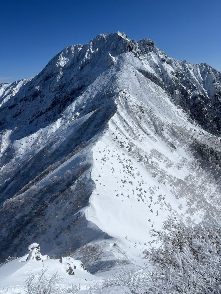
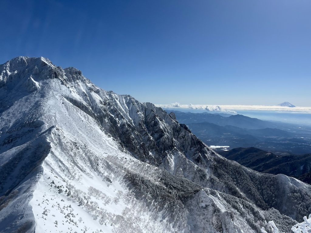
From the summit, you’ve got 2 main choices to get down: either head back down the way you came or keep going northwest and come down west the Okoyaone ridge. This is appealing, because it’s a bit different and it gets you right to Minotoguchi, but with 2 caveats: 1, there’s a short narrow ridge just off the summit before a little climb up a ladder and through some rocks before the easy descent – it was impossible to see the route when I was up there, and there are some big drops. And 2, the route down the west ridge is surprisingly trudgy once you hit the forest – it’s a fun way up, but a bit dull coming down. I took the second option and retraced my steps – the east face is very steep, but not difficult.
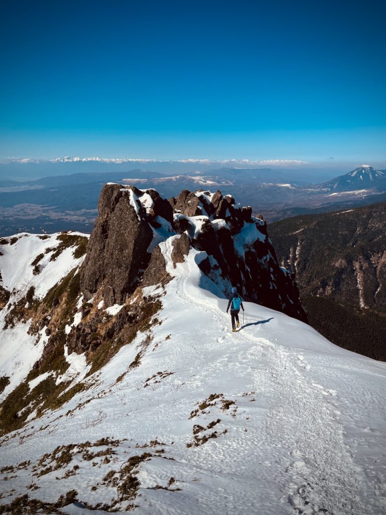
Overall, it’s a big an exciting day – quieter and feels more adventurous than its more popular slightly taller neighbour. And it’s fun to have climbed the scary looking one that always seems to be looming above you wherever you are in Akadake.